
Wetlands on the Map — What NWI Layers Mean for a Parcel You Love
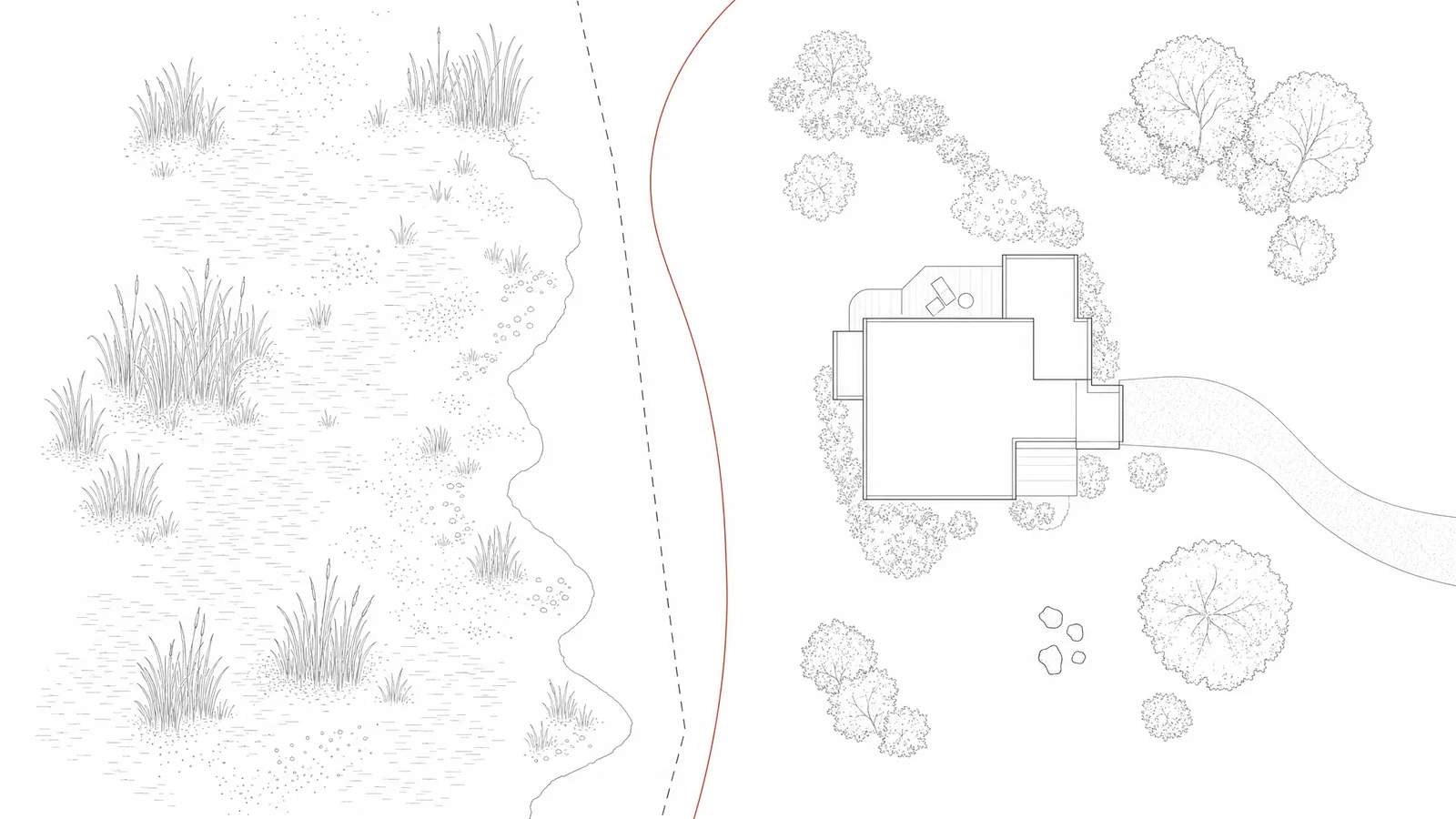
The National Wetlands Inventory is the federal atlas of wet ground: a free map layer, maintained by the U.S. Fish and Wildlife Service, that marks wetlands identified from aerial imagery and labels each one with a short code such as PEM1C or PFO1A. If a polygon touches a parcel you are considering, the deal is not dead. The code tells you what kind of wetland the mappers saw, and it points toward the permits that may govern an addition, a septic field, or a dock. Reading a code takes about a minute once you know its grammar — water source, vegetation, wetness, alteration. What the map cannot do is draw a legal boundary; only a field delineation can, and the difference between the two decides how much weight the polygon should carry in your offer.
A Map Drawn From the Air
The National Wetlands Inventory has been assembled since the 1970s by photointerpretation: trained analysts reading aerial and satellite imagery for the signatures of standing water, wet soil, and water-tolerant vegetation. The polygons you see in the Wetlands Mapper are those readings, digitized and coded.
Two properties of the map follow directly from that method. First, vintage varies. Some counties were re-mapped recently from high-resolution imagery; others still carry linework interpreted from photographs taken decades ago. Second, every boundary is an estimate. A line drawn from the air can sit tens of feet from where a soil scientist would place it standing in the field. The Service is direct about this: the maps decide nothing and carry no regulatory force. The inventory exists to tell you where to look harder — which is exactly how a careful buyer should use it.
Five Minutes in the Mapper
- Start at the Wetlands Mapper, launching its interactive map.
- Enter the property address in the search field. The map centers on the location over an aerial basemap.
- Zoom in until you can place the lot by its landmarks — roofline, driveway, fence lines, the tree line at the back. The Mapper does not draw parcel boundaries, so the aerial photo is your reference.
- Click every shaded polygon on or near the lot. A panel opens with the classification code and a written decode of each letter.
- Record where each polygon sits: under the building footprint, in the open yard, along the boundary, or entirely on a neighbor's land. Each position asks a different set of questions.
- Save a screenshot with the codes visible. You will want it for the conversations ahead — with the planning office, a soils consultant, or the seller.
The Grammar of a Wetland Code
Every NWI label follows the Cowardin classification, published in 1979 and still the federal standard for describing wetlands. A code reads left to right: where the water comes from, what grows there, how often the ground is wet, and whether people have altered it.
First letter — the water source
- P, palustrine. Freshwater marshes, swamps, wet meadows, and small ponds. On inland residential land, this is the letter you will meet most often.
- R and L, riverine and lacustrine. River and stream channels; lakes and their shorelines.
- E and M, estuarine and marine. Brackish and salt systems along the coasts.
Middle letters — the vegetation
- EM, emergent. Soft-stemmed plants: cattails, sedges, rushes. A marsh or wet meadow.
- FO, forested. Trees roughly twenty feet and taller — a red-maple swamp, bottomland hardwoods. From the road it reads as ordinary woods.
- SS, scrub-shrub. Alders, willows, buttonbush; shrubs and young trees.
- UB, unconsolidated bottom. Open water over mud or sand. A pond.
The tail — wetness and alteration
The capital letter near the end is the water regime. A means temporarily flooded: wet in spring, dry most of the year. C is seasonally flooded, E seasonally flooded and saturated, F semipermanently flooded, H permanently flooded. Lowercase letters flag human hands — d for ditched or partially drained, x for excavated, h for diked or impounded, b for beaver activity.
| Code | Plain reading | On the ground |
|---|---|---|
| PEM1C | Palustrine, emergent, persistent, seasonally flooded | Cattail or sedge marsh; standing water each spring |
| PFO1A | Palustrine, forested, broad-leaved deciduous, temporarily flooded | Maple or bottomland woods that dry out by early summer |
| PSS1E | Palustrine, scrub-shrub, seasonally flooded and saturated | Alder or willow thicket, spongy underfoot much of the year |
| PUBHx | Palustrine, unconsolidated bottom, permanently flooded, excavated | A dug pond |
| E2EM1P | Estuarine, intertidal, emergent, irregularly flooded | Salt marsh above the daily tide line |
The tail carries the useful signal. PFO1A is woods that dry by June; PUBH is water that never leaves. And any lowercase modifier deserves a pause, because someone changed the hydrology — the follow-up question is whether that work was permitted, since responsibility for unpermitted earthwork passes to the next owner with the deed.
What the Polygon Does to Your Plans
The building envelope
Section 404 of the Clean Water Act governs fill, grading, and construction in federally regulated wetlands: each requires a permit, issued by the U.S. Army Corps of Engineers. The rule applies to a garage pad or a widened driveway as surely as to a subdivision. Home-scale projects that qualify usually proceed under a nationwide permit — the residential one, NWP 29, caps permanent wetland loss at half an acre and requires notifying the Corps before work begins. The practical arithmetic for a buyer is simpler: the buildable area is the lot, minus the wetland, minus whatever buffer applies. Sketch the addition, the pool, or the workshop against the polygon before you write the offer, not after.
The septic question
A wetland on or beside a lot usually means a high seasonal water table somewhere close. State septic codes require separation between a leach field and both wetlands and seasonal high groundwater — horizontal setbacks of fifty to one hundred feet are common, plus several feet of vertical clearance. For a house with an existing system, ask its age, its last inspection, and where a replacement field would go if this one failed. For vacant land, make soil testing a condition of the purchase rather than a project for the first summer.
Docks, piers, and shoreline work
If the parcel fronts navigable water, structures such as docks and bulkheads fall under Section 10 of the Rivers and Harbors Act, administered through the Corps' regulatory program. Many districts authorize routine private docks through regional general permits, and states and towns layer shoreland rules on top. If the listing photographs a dock, ask to see its authorization. An unpermitted structure conveys to the buyer along with everything else.
Federal Reach, State Reach
Since the Supreme Court's 2023 decision in Sackett v. EPA, the federal program covers a narrower set of wetlands — broadly, those with a continuous surface connection to relatively permanent waters. The agencies are still revising the underlying definition of "waters of the United States"; EPA's WOTUS page tracks where that rulemaking stands.
For a buyer, this arithmetic is easy to get backwards. A wetland outside federal jurisdiction is not therefore buildable. Michigan and New Jersey administer the federal permit program within their own borders. Many other states run parallel wetland statutes of their own. And local governments commonly enforce buffers — twenty-five to two hundred feet is a typical range — measured from the wetland edge, inside which new structures, septic components, and clearing need approval or are simply barred. One call to the planning or conservation office, parcel number in hand, settles which rules apply to your address. Make the call before the offer.
An Inventory Is Not a Boundary
Buyers routinely conflate two different instruments.
An NWI polygon is an estimate drawn from imagery. It is free, instant, and indicative. It cannot tell you where a regulated wetland begins on your side of the fence.
A wetland delineation happens on the ground. Soils, vegetation, and hydrology are examined in person by a qualified consultant working from the Corps' delineation manual and its regional supplements; the boundary that emerges gets marked with flags, and a surveyor can then plot those flags onto the parcel. Budget in the high hundreds to low thousands of dollars for a typical house lot, with a report inside a few weeks.
If the legal answer matters — you plan to build, or the wetland covers ground you are paying for — the delineation can go one step further: a jurisdictional determination — the Corps' formal statement of which ground the federal program does and does not regulate. Requesting one costs nothing; an approved determination is generally honored for five years; and the wait can run to months, so start early.
Two situations call for field work even when instinct says otherwise. A clean NWI map over low, wooded ground is one, because small wetlands under a tree canopy are the hardest thing to catch from the air. A mapped polygon over ground that looks bone-dry at the showing is the other, because many regulated wetlands hold water for only a few weeks each spring. In the purchase contract, tie the offer to the delineation's outcome the same way you would tie it to an inspection.
Amenity or Constraint
The same polygon can be either. Position decides.
A wetland entirely behind the lot is mostly upside: permanent open space that is expensive or impossible to develop, privacy that does not depend on a neighbor's goodwill, birdlife, and a natural sponge that slows stormwater before it reaches your foundation. A polygon clipped to a back corner of the parcel is usually livable — leave it natural and plan around it. A polygon across the middle of the yard, or over the only ground that could host a septic field, is a constraint, and constraints belong in the price.
Two further signals shift the reading. Lowercase modifiers on the lot's own polygons — ditched, excavated, impounded — mean the hydrology has been worked on, and the paper trail matters. And wetlands mark low terrain, so pull the flood layer for the same footprint at msc.fema.gov; our guide to FEMA zone letters, decoded explains what the result means for insurance and lending.
Ten Questions to Settle Before You Offer
- Which codes appear on or within a few hundred feet of the lot, and what do their tail letters say about how long water stands?
- Does any polygon overlap the footprint, the septic area, or the only room to expand?
- Do any codes carry d, x, or h — and can the seller document permits for that alteration?
- What buffer does the state or town impose, and from which line is it measured?
- Where is the current septic field, when was it last inspected, and where is the reserve area?
- What FEMA flood zone covers the same ground?
- Is there a dock, bulkhead, or other shoreline structure, and who authorized it?
- What earthwork has touched the wet parts of the lot under this owner, and does paper exist for it? Put the question in writing.
- If the wetland sits on the far side of the line, what keeps it undeveloped — a recorded easement, town ownership, or only today's rules?
- Do your plans call for making the offer contingent on a delineation?
One Layer of Ten
A wetlands polygon is a single entry in an address's public record. Home RedFlags reads ten layers in one pass — USFWS wetlands beside FEMA floodplain standing and county disaster history, wildfire, seismic, landslide, Superfund and cleanup sites, industrial neighbors, radon, and drinking water systems — and grades each in plain language: Flagged, Look closer, Nothing found, or No data where the record is silent. Every finding arrives sourced, dated, and checkable, for $18 and one address. See how the wetlands layer reads in a sample report. For the rest of the homework, start with the weekend screening; and if the area carries industrial history, our Superfund proximity guide covers that side of the record.
A screening reads ten layers of public record for it — flood, wildfire, radon and Superfund among them — and grades each one in plain language, sources dated and linked. $18 once. No subscription.
Start a screening